Showing posts with label contacts. Show all posts

Saturday, October 21, 2017

Activation Report: Point Reyes, SOTA W6/NC-542 (and the aftermath)

On Thursday, August 31, I set out with the intention of activating Point Reyes Hill (W6/CC-071), which is located in the Point Reyes National Seashore. The normal way to access this summit is to drive up to the top of Mt. Vision Road, then walk in about one-half mile to the activation zone. However, when I turned onto Mt. Vision Road from the highway the road was closed and gated due to extreme fire danger (there was a "Red Flag" warning that day). Luckily, I had the option of an easy "Plan B": a SOTA summit known simply as "Point Reyes" (W6/NC-542) is located at the extreme end of the peninsula near the lighthouse, which is popular for public tours.

It was simply a matter of parking in the lighthouse parking lot and climbing a quarter of a mile or so to the top of the rock. Although it was hot and tinder-dry just a few miles inland, the point itself was cold, windy, and, at times, foggy.

The activation itself went off without a hitch, although it took approximately three hours to log the four contacts required to qualify (I ended up logging five contacts). My new Efactor antenna worked fine, although I was only able to log one contact: Joe, AA0BV, who just happened to be on Mt. Tamalpais, the site of my previous activation. I eventually logged four additional contacts on 20- and 40-meters SSB and called it a day. This is the point where my real adventure (or, rather, misadventure) began.

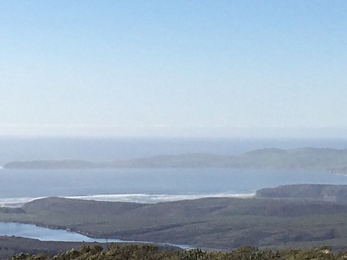
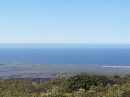
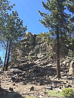
I successfully navigated through the scrubby brush, "bushwacking" my way down to the trail back to the parking lot. Within a few hundred yards of end of the trail, I stumbled on something and fell. I landed on my left shoulder; I suspect the weight of my backpack with the radio equipment contributed to the force of the fall, as I went down hard. (Luckily, I was nowhere near the edge of the cliffs that can be seen in the photos below.)

My first thought upon hitting the ground was "I hope no one saw that!" That quickly changed, however, when I realized that I no longer had the use of my left arm. I suspect that I had dislocated it at the shoulder--at least I hoped that that was the worst thing that happened. I rolled onto my back--I was still wearing the pack with radios--and laid there like an upside-down turtle, assessed myself, and weighed my options. I was able to move my wrist and wiggle my fingers, which was a good thing. There was no way I was going to be able to get up and move by myself, though. I reached for my cell phone with my right arm and...there was no signal. I started to get a little scared at that point.

Luckily I was in an area with many nearby tourists; I swallowed my pride and started calling "Help!" After a few minutes, a couple of people heard my call and came to my aid. For some reason, they wanted to sit me up then help me walk to my car; I was having none of that, as any attempt to do so caused excruciating pain and discomfort. I told them I needed an ambulance. More people began to show up and someone volunteered to go call 9-1-1.

I estimate that it took at least 30 more minutes before someone reached a location where they had a strong enough signal to make the phone call. After that, it took 20-30 minutes for the Marin County Fire Department engine company and ambulance to respond from the nearest town (Point Reyes Station). In the meantime, a park ranger arrived and stayed with me.

When the paramedics and additional rangers finally arrived, they secured my arm, loaded me on a stretcher, and carried me to the ambulance. What followed after that was a long two-hour, winding, bumpy ride to Marin General Hospital in Greenbrae. Fortunately, the paramedic was able to give me morphine so that it would not be too painful.

At the hospital, x-rays showed that I had suffered an impact fracture of my humerus (upper arm bone) just below the ball joint in the shoulder; there were actually a number of small fractures, and the shaft of the bone was displaced. It was a pretty bad break.

To make a long story short, I continue my recovery as I write. On September 11, I underwent surgery, in which a metal plate and eleven screws were necessary to put the bone back together (as I said, it was a bad break). In the time since the operation, I have been doing physical therapy to regain full (-ish) use of the arm. The physical therapist says I am making good progress, although it seems slow to me (I have to keep reminding myself how lucky I am that it was not worse, as bad as it was). I have been wearing a bulky sling since I was injured and expect to until the end of October, at least.

I hope to be able to return to work sometime in mid-December. I work for Amtrak as a passenger train conductor, so it's imperative that I get as close to full-function of my arm as possible before I do return. I am fortunate to have access to short term disability payment plans from both the Railroad Retirement Board and my union, so I should not run out of money in the interim.

It has taken so long for me to post this story because I only recently have been able to start using both hands to type.

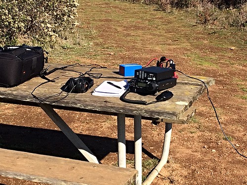
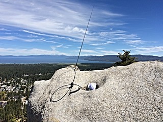
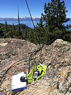
Portable station W6SAE, set up for SSB operation on 2 meters.

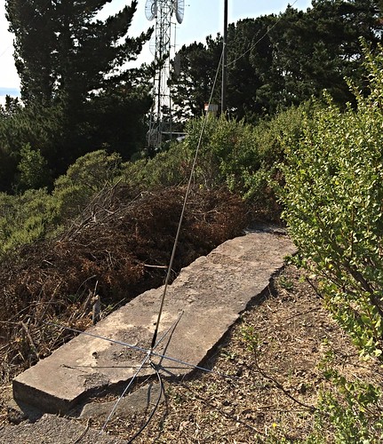
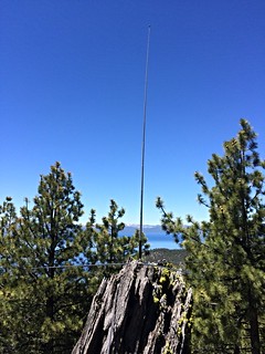
Here is a closeup of the Efactor Dual-Band 144/432 MHz antenna in action.

This is my Yaesu ATAS-25 antenna, for HF SSB, and VHF FM.

Another view of the operating position.


Sunday, July 9, 2017

Catching Up (Again): SOTA Activations

First of all, I would like to apologize to anyone who has been following this blog; I have not been keeping it up-to-date. I have been pretty active, especially in regards to Summits on the Air (SOTA) activity, but I have not been as motivated to maintain the blog as I should be.

I have activated 16 summits since my last activation report (Mt. Tamalpais, W6/CC-063) on December 17, 2016. So far, they have all been in Northern California:

  • 29 December 2016: W6/CC-051 (North Peak), 2 points -- Highlights: QSO with AC1Z in New Hampshire on 20 meters (14 MHz), plus three summit-to-summit (S2S) contacts and two National Parks on the Air (NPOTA) contacts. I was operating with 50 watts, single-sideband (SSB).
  • 15 January 2017: W6/CV-017 (968), 1 point -- Highlight: N4DA, near Atlanta, Georgia, on 20 meters SSB.
  • 31 January 2017: W6/NC-406 (Sulphur Springs Mountain), 0 points -- I only logged three contacts on 40 meters SSB, and did not qualify (a minimum of four is required). Conditions were tough on this day.
  • 14 March 2017: W6/CC-049 (Cold Spring Mountain), 2 points -- I logged my first contacts on 15 meters (21 MHz) SSB: K3TCU in Pennsylvania, and W9MRH and WA2USA in Indiana.
  • 30 March 2017: W6/NC-151 (Mount Vaca), 2 points -- My longest-distance QSO was with WA2USA in Indiana on 14 MHz SSB.
  • 2 April 2017: W6/NC-422 (990), 1 point -- I initially tried taking part in the AM Rally but was hampered in part by a solar flare. I was able to log some good QSOs on 20 meters SSB, including two each in Minnesota, Kansas, and Montana. Also, an S2S with W6CLB, who was doing his first SOTA activation nearby.
  • 22 April 2017: W6/NC-432 (Chabot 2 Benchmark), 1 point -- Conditions were badly deteriorated on this day, but I was able to log the minimum four contacts over a two-hour period. On a positive note, I was able to log two S2S contacts, with AC2KL in Utah and NS7P in Oregon on 40 meters (7 MHz) SSB.
  • 2 May 2017: W6/NC-298 (Vollmer Peak), 1 point -- Once again, difficult conditions but I was able to log the four QSOs needed to qualify. 
  • 2 May 2017: W6/CC-045 (Mount Diablo), 2 points -- Most contacts logged were on 2 meters (146.520 MHz FM), but I did log three contacts on 20 meters SSB with Arizona and New Mexico.
  • 11 May 2017: W6/NC-010 (Goat Mountain), 6 points -- Three of my five contacts were on 17 meters (18 MHz) SSB.
  • 23 May 2017: W6/NC-379 (Taylor Mountain), 0 points -- I was only able to eke out two contacts: W0MNA in Kansas, barely readable on 20 meters SSB, and K6EL, loud and clear from San Francisco on 15 meters SSB. I left my 2-meter handheld radio in the car; otherwise I might have been able to round out my contacts on 146.520 FM and have qualified.
  • 4 June 2017: W6/NC-417 (Abrott Benchmark), 1 point -- As has become common for me, I was just able to log the minimum four QSOs need to qualify: two each on 40 and 20 meters SSB.
  • 15 June 2017: W6/NS-290 (Big Hill), 6 points -- My first Sierra Nevada activation of the year, this summit features very easy access and spectacular views. I logged 8 contacts on 40, 20, and 17 meters (SSB) and 2 meters FM.
  • 27 June 2017: W6/NS-248 (7008), 6 points -- Hill 7008 is located at South Lake Tahoe, California, literally across the street from the airport. Four QSOs on 40 and 20 meters SSB with Oregon, Arizona, and Texas.
  • 28 June 2017: W6/NS-397 (Tahoe Mountain), 6 points -- Virtually a stone's-throw away from the previous summit; once again four contacts to qualify (20 meters SSB), plus one local on 146.520 FM with WA6EWV for good measure.
  • 1 July 2017: W6/SN-039 (Leviathan Peak), 8 points -- I stopped here on my way home from South Lake Tahoe. The spectacular views of the Sierra Nevada mountains and the state of Nevada made it totally worth the mere four contacts that I logged. A highlight was an S2S with AE7AP in Montana.

Saturday, December 17, 2016

Activation Report: SOTA W6/CC-063

Today I went to the summit of Mount Tamalpais, in Marin County across the Golden Gate from San Francisco, intending to attempt a "summit-to-summit" contact with my friend Andrew, VK1AD, who was activating Mount Stromlo (VK1/AC-043) in the Australian Capital Territory. Much to my chagrin, I left my freshly-charged 12-volt battery sitting on the kitchen counter at home and was unable to work any HF. It was also a little embarrassing, as a father and his two young sons were watching me set up my rig in hopes of seeing me operate my radio. It was a little awkward for all of us when I realized what I had done.

I had brought a handheld FM radio (a Yaesu VX-6R), however, and was at least able to log 9 contacts on the 2-meter band (146.520 MHz FM) and qualify for an activation of the summit.


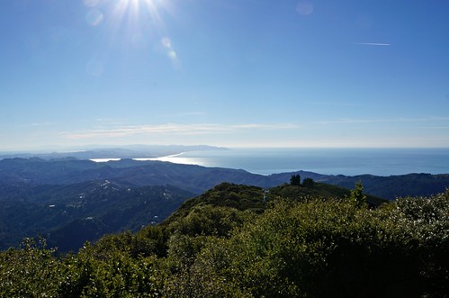
Looking South from Mt. Tamalpais
Looking south, with San Francisco in the distance.

Looking South-Southwest from Mt. Tamalpais
The Pacific Ocean, over which I had hoped to talk to VK1AD.

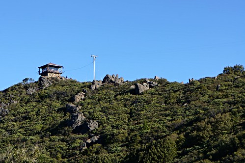
Mt. Tamalpais
The summit of the east peak of Mt. Tamalpais, as seen from below.

Thursday, December 1, 2016

Portable/Mobile on Mt. Vaca

Today I drove up to near the summit of Mount Vaca (SOTA W6/NC-151), put my Yaesu ATAS-25 antenna on the roof of my car, and "tuned the bands" to see what I would come up with. I didn't operate as a Summits-On-The-Air activation; I was operating from my vehicle--a SOTA no-no, plus I already activated the summit this year.

I logged four contacts:
  • On 20 meters (14.340 MHz), I chased KD0YOB, who was activating Iron Mountain (SOTA summit W0C/MZ-031) in northern Colorado, gaining four chaser points for myself. The distance was approximately 822 miles (1323 km).
  • On 14.275 MHz, I chased N4CD, who was conducting a National Parks on the Air (NPOTA) activation at Carlsbad Caverns National Park (NP10) for a distance of approximately 1,079 miles (1736 km).
  • On 17 meters (18.125 MHz), I responded to a CQ from Norm, NH6I, on the "Big Island" of Hawaii (approximately 2,419 miles [3893 km] away). This is my longest-distance contact thus far.
  • On 40 meters (7.230 MHz) I logged another NPOTA contact, this time with K6WDE, who was operating from the Mojave National Preserve (PV13) in the Southern California desert, a little over 400 miles (644 km) away.
On the first three contacts, I needed to run 75 watts to be heard; 50 watts was sufficient for the last one.


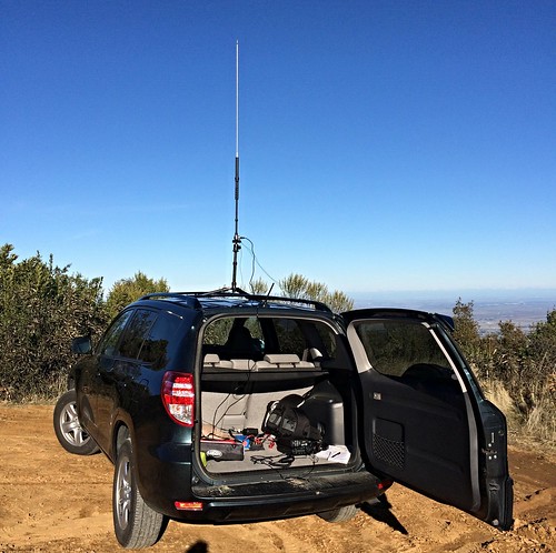
Mobile/Portable
My trusty Yaesu FT-857D is ready for action in the back of my RAV4.

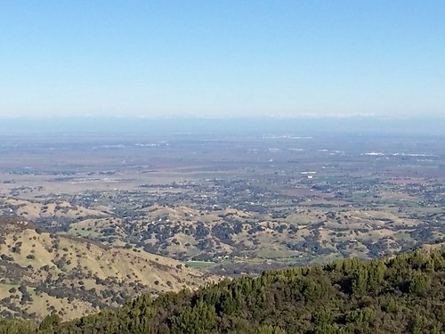
Untitled
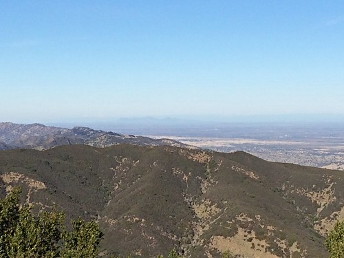
Looking east, with Sacramento and the Sierra Nevada mountains in the distance.

Untitled
Looking northeast; in the distance, the Sutter Buttes can be seen rising from the floor of the Sacramento Valley.

Untitled
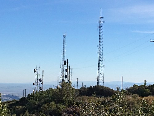
These are just a few of the many radio towers that line Blue Ridge.

Untitled
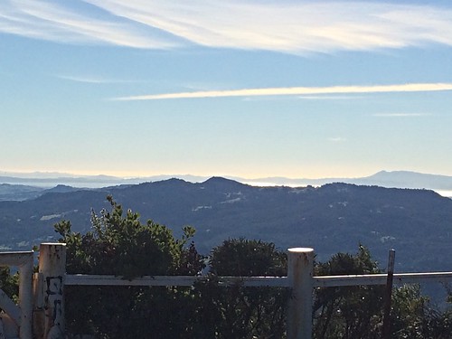
Looking west toward San Francisco Bay, with Mt. Tamalpais in the distance at right center.

Activation Report: SOTA W6/CC-071

On Tuesday, November 29, I activated Point Reyes Hill (elevation 1336 feet [407 meters]), which is located within the boundaries of the Point Reyes National Seashore. Access is quite easy, with a short .4-mile walk from the gate at the end of the road near the top of the hill.

While driving the road up the hill, I encountered another ham. Fred, N6YEU, was activating Point Reyes for National Parks On The Air (NPOTA). He was operating from the camper on the back of his pickup truck; the large inverted-v dipole antenna projecting above the truck is what caught my eye and identified him as a ham. After chatting with Fred for a few minutes, I continued a short distance up the road to the parking area near the gate.

The activation area at the top of the hill has spectacular views of the seashore and the Pacific Ocean. There is also, quite conveniently for a radio operator, a picnic table. The sky was crystal clear, with a few light clouds overhead and some fog over the ocean in the distance. There was just light breeze; it was hard to believe that it had been rainy and stormy for the several days prior.

I set up my rig and started calling "CQ" on the 20-meter band (14.310 MHz). It took a little time before I logged my first contact, NQ7R in Arizona. Two minutes later, I heard from the aforementioned Fred, N6YEU, who was just down the hill from me. He also responded 35 minutes later, after I rolled over to 7.239 MHz (40 meters). I logged a total of eight contacts over a period of just over two hours, including another Arizona station, two from New Mexico, and one from Southern California. A highlight was a Summit-to-Summit with K6YOA/P on Ryan Mountain Mountain (W6/CD-016) in the Joshua Tree National Monument, also another NPOTA contact.


W6SAE, SOTA W6/CC-071
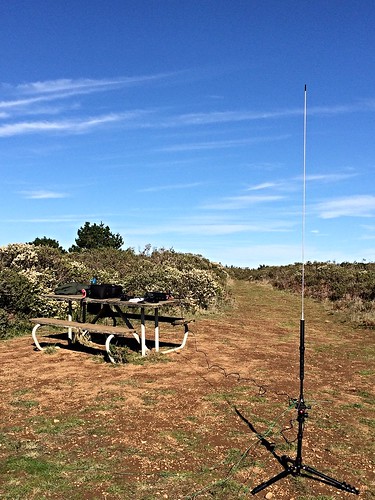
A perfect spot for a hilltop radio station. The antenna is a Yaesu ATAS-25.
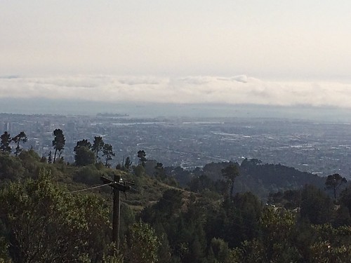
W6SAE, SOTA W6/CC-071
Portable radio station W6SAE: Yaesu FT-857D transceiver, LDG Z-11 Pro II antenna tuner, LiFePo4 battery, and MFJ headphones.

W6SAE, SOTA W6/CC-071

Wednesday, November 23, 2016

W6SAE (Portable) Log

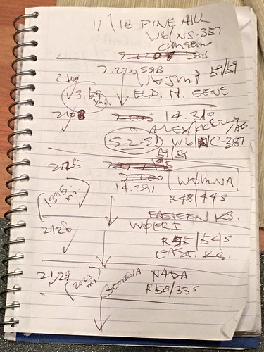
This is a page from the notebook I use when I'm operating portable, in the field. It's the first page from my most recent Summits-On-The-Air (SOTA) activation, on Pine Hill in Northern California. Some of the notations (the check-marks, distances, "Georgia") were added later, after I got home and started to enter the information in the computer.

W6SAE Logbook

Translation of the stations logged:
W6JMP (Gene, El Dorado Hills, CA--less than 4 miles away)
KK6ZLY/AG (Alex, on another SOTA summit--"S-2-S!")
W0MNA (in eastern Kansas)
W0ERI (in eastern Kansas)
N4DA (in Georgia [!])

This was my first time on HF, so I was pretty excited about the Kansas and Georgia QSO's.

Saturday, November 19, 2016

Activation Report: SOTA W6/NS-357

Yesterday (November 18), I activated Pine Hill, near the community of Rescue in the Sierra Nevada foothills, 25 miles or so east of Sacramento in El Dorado County. It has an elevation of 2,059 feet (628 meters). It's located in the Pine Hill Preserve, home to a number of unique species of plants and animals. The summit is open for public access, as long as visitors keep to the trails.

This was to be my first expedition in which I operated HF in single-sideband (SSB) mode, as opposed to my usual VHF/UHF FM. I tried not to set my expectations too high, as it was planned at the last minute and I felt somewhat disorganized. In addition, I was not fully confident that I really knew what I was doing when it came to SSB. (High Frequency or "HF" are the bands with which one tries for the long-distance "DX" contacts.)

I was able to drive in to within about 6/10 of a mile from the summit, where there is a gate for pedestrian access. The walk up the paved private road was relatively easy. Once at the top, the view was impressive, as can be seen through my photos.

After I caught my breath and collected myself, I set up the radio and antenna, plugged in the headphones, and double-checked to make sure that I was operating within my frequency privileges. Then I spotted myself on the SOTA Goat app to advise the chasers that I was on the air.

I tried the 40-meter band (7.220 MHz) first. I called "CQ SOTA" and immediately received a response from Gene, W6JMP. Gene's QTH (station location) was 3.69 miles away in El Dorado Hills--I literally drove right by his house on my way to the hill...well, at least my signal was getting out.

After several fruitless minutes on 40 meters, I decided to switch to 20 meters. As I was spotting myself on SOTA Goat I saw that an acquaintance, Alex, KK6ZLY/AG, had just spotted himself on Hill 1272 (W6/NC-387), approximately 73 miles (118 km) to the southwest. I rolled over to 14.310 MHz just in time to hear him calling CQ. I logged my first "Summit-to-Summit" contact, and 73 miles was better than 3.89--but I was still not setting any records for distance.

Encouraged by this QSO, I switched to 14.291 MHz and, after confirming the frequency was clear, started calling CQ myself. At 2125 hours UTC (1:25 p.m. local), W0MNA responded, followed by W0ERI a minute later. Their QTH? "Eastern Kansas." Roughly 1,395 miles (2244 km) away. Now, this is what I got into the hobby for! Their signals were quite strong and clear; mine was slightly less so on their end.

Three minutes later, N4DA.  His signal was quite strong on my end, although mine was apparently not so good on his end. We were able to successfully complete the QSO, though. Because of the difficulty hearing me on his end, I never caught his QTH. I made a mental note to look up his callsign when I got home.

N4DA was my last contact on HF, and after another 10 minutes or so I switched over to 146.520 MHz (FM) to drum up a few local contacts. I logged four in quick succession, the furthest over 90 miles away in Lake County, California. My grand total for the day was nine QSO's.

I packed up my rig: a Yaesu FT-857D, running through an LDG Z-11 Pro II antenna tuner to a Yaesu ATAS-25 portable vertical antenna--I operated with 50 watts on 40 and 20 meters, 5 watts on 146.520.

As I drove home, I wondered about N4DA. I knew that Region 4 was in the southeastern U.S., but operators here are not required to change their prefixes when they move so I wasn't sure. As soon as I got home I went to the computer and looked him up: Cartersville, Georgia, 2,023 miles (3255 km) away! And with 50 watts and a small vertical antenna on my end.

All in all, not bad for my very first attempt at HF. Especially considering my lack of confidence when I started. Needless to say, my confidence--and enthusiasm--shot way up.

Clicking on any image below will enlarge it.


W6SAE, SOTA W6/NS-357
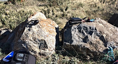
Portable station W6SAE; those rocks made a convenient work station.
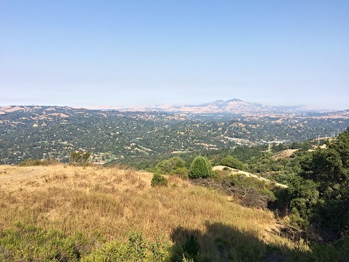
W6SAE, SOTA W6/NS-357
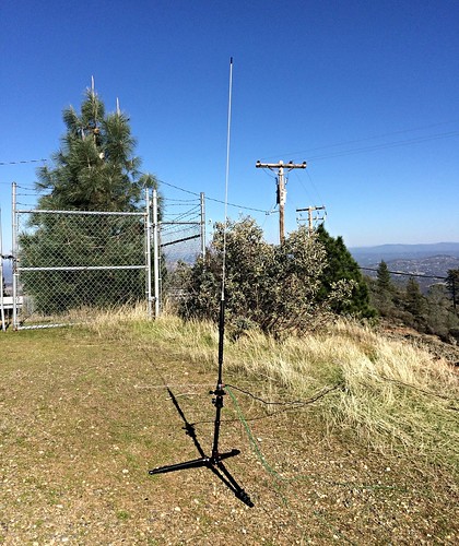
Yaesu ATAS-25 ("Active Tuning Antenna System"), configured for HF--it gave me contacts 2,023 and 1,395 miles to the east, far beyond those mountains in the distance.

W6SAE, SOTA W6/NS-357
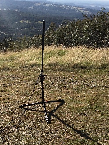
The ATAS-25 configured for VHF/UHF, local and regional distances.

The views were impressive:
W6SAE, SOTA W6/NS-357

A Visit to HRO and a Quick SOTA Activation (Last Catch-Up Post)

On Saturday, November 5, I paid a visit to Ham Radio Outlet (HRO) in Oakland, California, with a small shopping list in hand. I had two goals in mind: (1) getting my new end-fed HF antenna up and operational, and (2) setting up my Yaesu FT-857D for portable (SOTA) operations.

A couple hundred dollars later, I headed southeast to nearby San Leandro to W6/NC-432 (Chabot 2 Benchmark) for a quick and easy SOTA activation. I thought I had shot some photos, but apparently not since I can't find them on my iPhone. There was a great view of San Francisco Bay and the cities of the East Bay.

The highlight of this otherwise uneventful activation was that I actually got a couple of bites on 6 meters (50 MHz band).

K6EL, KK6ZLY, and K6JEL are all fellow SOTA junkies.

Activation Report: SOTA W6/CC-045 Mt. Diablo (Still Catching Up)

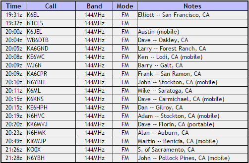
On Tuesday, September 13, I activated Mount Diablo (elevation 3,849 feet/1173 meters), a very prominent feature that is visible throughout much of northern and central California. Due to this, a CQ ("calling any station") from its summit is usually guaranteed to draw a great response from a wide area. I logged 18 QSO's (contacts) on this date, all on the 2-meter band (FM).

Larry, KA6GND, in Forest Ranch was approximately 138 miles (222 km) away; not bad for 2 meters.

The views are pretty amazing:

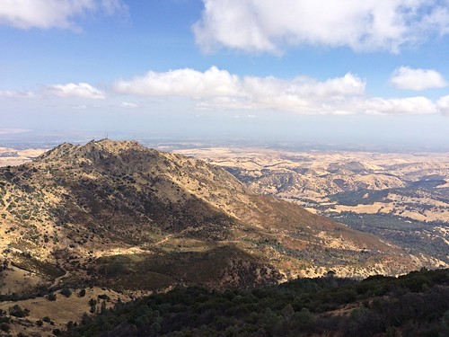
The view from Mt. Diablo

SOTA Chases of the Last Few Months (Continuing to Catch Up)

As you can see below I've been active chasing other SOTA activators' summits as well--twelve since late August. Phil, KK6YYD, continues to be the most common one I catch.

(Click on the image to enlarge it.)

I will talk about the last log entry (KK6ZLY/AG) very soon in an upcoming post.

Catching Up

So, what have I been doing for the last three months? Where to begin...

The fourth week of August found me in Oakland, California, for four days of annual training and testing (I work as a conductor for Amtrak, America's passenger railroad). Two of those days, I found nearby summits in the Oakland Hills to activate for Summits on the Air--Oakland is in the "East Bay," across the bay from San Francisco. Both activations were pretty straightforward, with relatively easy climbs. As usual, I was operating on the 2-meter band (144 MHz) in FM mode.

Vollmer Peak (W6/NC-298), located above Berkeley was the first (on Tuesday, August 23); I logged seven contacts, all from the San Francisco Bay Area.


W6SAE, SOTA W6/NC-298
Portable station W6SAE, Vollmer Peak.

W6SAE, SOTA W6/NC-298
My trusty "homebrew" portable 2-meter antenna at work on the summit of Vollmer Peak.

W6SAE, SOTA W6/NC-298
Looking southwest from Vollmer Peak toward the city of Oakland and San Francisco Bay.

W6SAE, SOTA W6/NC-298
This is the view to the east from the trail up to the summit of Vollmer Peak,
with Mt. Diablo (W6/CC-045) in the distance. Quite a different look than that from the west (S.F. Bay) side of the hill, with its cold winds and fog.

The next day, August 24, I worked W6/NC-398, otherwise known as Hill 1180 for its elevation. It is located a few miles south of Vollmer Peak in the same range of hills. I logged just five contacts, including a couple of stations from the previous day.


I didn't bother to shoot any pictures that day.

Sunday, August 21, 2016

24 Easy SOTA Chaser Points

Phil, KK6YYD, activated three summits today: W6/NS-179 (Signal Peak), W6/NS-389 (Buzzard Roost), and W6/NS-155 (Sand Ridge). I logged contacts with him on all three summits, which are in the northern Sierra Nevada and well over 90 miles away from my home QTH (station). Each of them was worth 8 points; I was able to more than double my chaser points, from 15 to 39. He was working 146.520 MHz FM.

Thursday, August 4, 2016

My First QSL Card!

I just received the first of what I hope will be many QSL cards over the coming years. It confirms this Summits-on-the-Air (SOTA) QSO (contact) with Phil, KK6YYD, of Placerville, California.
Along with this card comes the realization that I should start thinking about designing my own card.

Sunday, July 24, 2016

5 Watts, Nearly 100 Miles

Today, I logged a Summits-on-the-Air contact with Philip, KK6YYD (my role was that of "chaser"). He was activating Mt. Price (W6/NS-377), near South Lake Tahoe, California. We were on 2 meters (146.520 MHz) FM. I find this contact to be especially noteworthy because we were both operating at 5 watts (indoors on a handheld, in my case) and were approximately 98 miles (158 km) away from each other. It was a clear, hot, sunny day of over 100 degrees Fahrenheit (37+ degrees Celsius); could that have been a factor in helping the propagation?

Sunday, June 26, 2016

Activation Report: SOTA, Lake Tahoe Basin

I activated three summits in the Lake Tahoe Basin last week and earned 16 points.

On Wednesday, June 19, I activated SOTA W6/NS-248, known simply as "7008" after its elevation in feet. It was a pretty straightforward hike--and not too difficult--up a jeep road most of the way, followed by a few hundred yards of "bushwhacking" up to the summit. As with the next summit, I was just able to eke out the four contacts necessary to earn the six points.


KK6ZLX, SOTA W6/NS-248
Here is a highlight from the hike up the jeep road to the summit.

KK6ZLX, SOTA W6/NS-248
This is the view to the west, looking toward Desolation Wilderness.

KK6ZLX, SOTA W6/NS-248
Portable station KK6ZLX. Shortly after I shot this photo, a gust of wind blew the antenna over the side; I was able to grab the coax cable just in time.

Tuesday, June 21: My next activaton was W6/NS-397, Tahoe Mountain, elevation 7,249 feet (2209 meters). This was another fairly easy climb, this time along a popular hiking/mountain bike trail. As with Pt. 7008 above. The summit is mostly tree-covered, although there are some nice views of Lake Tahoe. I must admit that I initially set up on the wrong summit, a quarter of a mile or so north down the ridge from the correct one. Luckily, my conversation with my first contact, Paul, WA6EWV (who had been on Tahoe Mountain before) helped me to realize the error of my ways. After relocating, it took me almost 40 minutes to log the necessary four contacts.


Wednesday, June 22: My final activation was W7N/TR-027, Captain Pomin Rock, elevation 7,538 feet (2298 meters), which is located on the eastern shore of the lake in Nevada. My plans for this particular day changed several times. Initially, I was going to activate South Maggies Peak but decided that it might be a bit too much for me after the previous day's climb. I decided to try Monument Peak, located on Forest Service lands in the Heavenly Valley Ski Resort. Despite it's very high elevation (10,000-plus feet), it seems that it would have been a pretty easy ascent on account of the fact that most of the distance could be covered riding in a gondola and a chairlift. Unfortunately, this plan fell through due to snow on the summit. After referring to my handy SOTA Goat app, I finally settled on Plan C: Captain Pomin Rock, which is located a short distance off the highway, 10 miles or so to the north.

I was only able to log two contacts on this summit. Not being comfortable scaling to the top of the rock, I ended up trying several different locations on the side of it. In spite of vast panoramas of the lake from these locations, I had little luck. My first contact was Gary, K7ORG in Reno (on the far side of a large mountain ridge). Almost an hour later, Aaron, KG7DLC happened to be driving along the highway adjacent to my location and responded on his mobile radio. After three hours of attempts from several different positions, I had to give up and head home to the cabin. I got no points, but at least I received credit for an activation.

I suspect that trees in front of me--along with the rock right behind me--may have worked against me; still, there was that contact with Reno, 30 +/- miles away over a high ridgeline...

KK6ZLX, SOTA W7N/TR-027
Captain Pomin Rock (W7N/TR-027).

KK6ZLX, SOTA W7N/TR-027
My homebrew portable 2-meter antenna, with beautiful Lake Tahoe in the background.

KK6ZLX, SOTA W7N/TR-027
Portable station KK6ZLX, one of a number of spots where I set up.

Thursday, May 19, 2016

Activation Report: SOTA W6/NC-151

Today's activation of Mount Vaca was probably one of the easiest that I'll have in the course of my SOTA activities. I was able to drive to within 100 yards or so of my activation point on the summit. The road up Mix Canyon is very steep, winding, and narrow, but at least it's paved. There are multiple radio tower sites strung out along the ridge line, including several of the region's most popular ham radio repeaters. Fortunately, they didn't seem to interfere much with my operation.

One of my goals has been to log contacts on some of the bands that don't see much SOTA activity in this region, specifically 6 meters, 1.25 meters, and 70 centimeters (FM). I am happy to report that I logged contacts on each of these bands today. Granted, there was only one QSO per each band (and two of those were with the same chaser); it was quite satisfying to hear someone on the other end, though. Elliott, K6EL, in San Francisco, answered my call on 52.525 MHz (and also on 146.520, later). Dave, WB6DTB, in Oakley, was kind enough to follow me over from 446.000 to 223.500. Nine QSOs on 2 meters (146.520) made up the balance for a total of twelve.

I used my Yaesu VX-6R on 2 meters and 70 centimeters, a Wouxun KG-UV5D on 6 meters, and a TYT TH-UVF9 for my 1.25-meter contact. As an experiment, I tried my homebrew portable 2-meter antenna on 6 and 1.25 meters and it seemed to work well. I used a Maldol MH-510 whip for 70 cm.

The most distant contact was with Steve, KK6BNJ, approximately 70 miles to the southeast in Jenny Lind. I find this somewhat remarkable because I was situated just over the edge on the west side of the summit, with two very large (active) radio towers between us.


Looking east, toward the Sacramento Valley

Looking west, with Lake Curry below

Far to the south, Mt. Diablo sticks out through the haze.

Looking north, with one of the numerous radio sites

Portable station KK6ZLX. The homebrew antenna gave a stellar performance.