On Wednesday, June 19, I activated SOTA W6/NS-248, known simply as "7008" after its elevation in feet. It was a pretty straightforward hike--and not too difficult--up a jeep road most of the way, followed by a few hundred yards of "bushwhacking" up to the summit. As with the next summit, I was just able to eke out the four contacts necessary to earn the six points.
Here is a highlight from the hike up the jeep road to the summit.
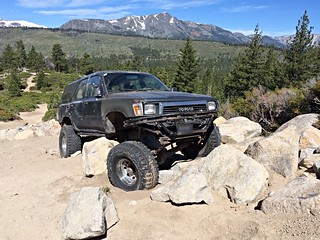
This is the view to the west, looking toward Desolation Wilderness.
Portable station KK6ZLX. Shortly after I shot this photo, a gust of wind blew the antenna over the side; I was able to grab the coax cable just in time.
Tuesday, June 21: My next activaton was W6/NS-397, Tahoe Mountain, elevation 7,249 feet (2209 meters). This was another fairly easy climb, this time along a popular hiking/mountain bike trail. As with Pt. 7008 above. The summit is mostly tree-covered, although there are some nice views of Lake Tahoe. I must admit that I initially set up on the wrong summit, a quarter of a mile or so north down the ridge from the correct one. Luckily, my conversation with my first contact, Paul, WA6EWV (who had been on Tahoe Mountain before) helped me to realize the error of my ways. After relocating, it took me almost 40 minutes to log the necessary four contacts.

Wednesday, June 22: My final activation was W7N/TR-027, Captain Pomin Rock, elevation 7,538 feet (2298 meters), which is located on the eastern shore of the lake in Nevada. My plans for this particular day changed several times. Initially, I was going to activate South Maggies Peak but decided that it might be a bit too much for me after the previous day's climb. I decided to try Monument Peak, located on Forest Service lands in the Heavenly Valley Ski Resort. Despite it's very high elevation (10,000-plus feet), it seems that it would have been a pretty easy ascent on account of the fact that most of the distance could be covered riding in a gondola and a chairlift. Unfortunately, this plan fell through due to snow on the summit. After referring to my handy SOTA Goat app, I finally settled on Plan C: Captain Pomin Rock, which is located a short distance off the highway, 10 miles or so to the north.
I was only able to log two contacts on this summit. Not being comfortable scaling to the top of the rock, I ended up trying several different locations on the side of it. In spite of vast panoramas of the lake from these locations, I had little luck. My first contact was Gary, K7ORG in Reno (on the far side of a large mountain ridge). Almost an hour later, Aaron, KG7DLC happened to be driving along the highway adjacent to my location and responded on his mobile radio. After three hours of attempts from several different positions, I had to give up and head home to the cabin. I got no points, but at least I received credit for an activation.
I suspect that trees in front of me--along with the rock right behind me--may have worked against me; still, there was that contact with Reno, 30 +/- miles away over a high ridgeline...
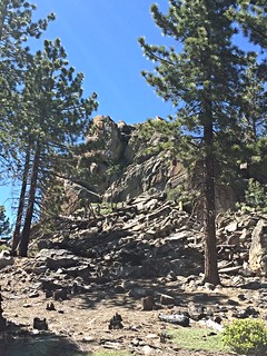
Captain Pomin Rock (W7N/TR-027).
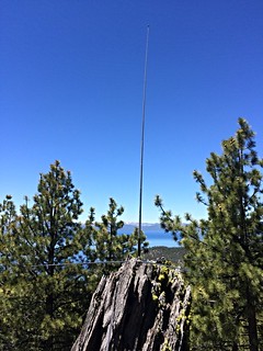
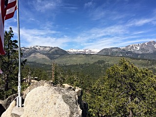
My homebrew portable 2-meter antenna, with beautiful Lake Tahoe in the background.
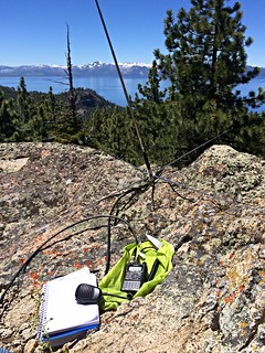
Portable station KK6ZLX, one of a number of spots where I set up.
No comments:
Post a Comment